IGN Sismología
The ign_sismologia integration集成将 Home Assistant 与您的设备、服务等连接和集成。 [Learn more] lets you integrate a GeoRSS feed provided by the
Spanish Instituto Geográfico Nacional
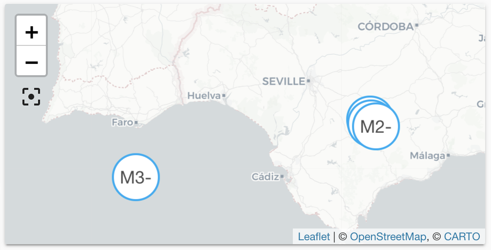
Entities are generated, updated and removed automatically with each update
from the feed. Each entity defines latitude and longitude and will be shown
on the default map automatically, or on a map card by defining the source
ign_sismologia. The distance in kilometers is available as the state
of each entity.
The data is updated every 5 minutes.
Configuration
To integrate the IGN Sismología feed, add the following lines to your configuration.yamlconfiguration.yaml 文件是 Home Assistant 的主要配置文件。它列出了要加载的集成及其特定配置。在某些情况下,需要直接在 configuration.yaml 文件中手动编辑配置。大多数集成可以在 UI 中配置。 [Learn more] file.
在更改了configuration.yamlconfiguration.yaml 文件是 Home Assistant 的主要配置文件。它列出了要加载的集成及其特定配置。在某些情况下,需要直接在 configuration.yaml 文件中手动编辑配置。大多数集成可以在 UI 中配置。 [Learn more] 文件后,重启 Home Assistant 以应用更改。 该集成现在显示在集成页面的 设置 > 设备与服务 下。其实体在集成卡片上以及实体标签上列出。
# Example configuration.yaml entry
geo_location:
  - platform: ign_sismologia
Configuration Variables
The minimum magnitude of an earthquake to be included.
The distance in kilometers around Home Assistant’s coordinates in which seismic events are included.
Latitude of the coordinates around which events are considered.
Latitude defined in your configuration.yaml
State Attributes
The following state attributes are available for each entity in addition to the standard ones:
| Attribute | Description |
|---|---|
| latitude | Latitude of the earthquake. |
| longitude | Longitude of the earthquake. |
| source |
ign_sismologia to be used in conjunction with geo_location automation trigger. |
| external_id | The external ID used in the feed to identify the earthquake in the feed. |
| title | Original title from the feed. |
| region | Textual description of named geographic region near to the event. |
| magnitude | Reported magnitude of the earthquake. |
| publication_date | Date and time when this event occurred. |
| image_url | URL to a map supplied in the feed marking the location of the event. This could for example be used in notifications. |
Full Configuration
# Example configuration.yaml entry
geo_location:
  - platform: ign_sismologia
    radius: 100
    minimum_magnitude: 2.0
    latitude: 37.39
    longitude: -5.99